Category IV arable land near Kostinbrod
A 2,099 m² category IV arable parcel in Kostinbrod’s Perena locality, with no cadastral buildings stated by the source. The current individual offer now shows €13,440, reduced from €16,800. Treat it as agricultural land while independently checking boundaries, access, leases and any future planning route.
2,099 m² agricultural land, category IV; no cadastral buildings stated.
Why we selected this property
The specific features behind our editorial selection.
Defined agricultural category
Category IV arable designation is explicitly stated, useful for a buyer comparing agricultural parcels.
Per source · independent confirmation neededIdentifiable parcel marketing
The gallery annotations give identifier 38978.261.4, a concrete reference to match against official documents.
Visible in the reviewed photographsCurrent price clarified
The individual source now shows €13,440 and €16,800 as the former price, supporting a catalogue correction.
Per source · independent confirmation neededThe property in detail
The source identifies 2,099 m² of agricultural land with permanent use as arable field, category IV, in Perena near Kostinbrod. It states that no buildings are recorded in the cadastre. Those are the relevant starting facts for an agricultural purchase; the advertisement does not establish residential or commercial building rights, connected services or a completed change of use.
The gallery contains a parcel map and publisher-annotated landscape images with a white outline and the identifier 38978.261.4. These illustrate the marketed plot and wider setting, but their overlays do not replace a cadastral sketch, survey or an on-site boundary check. The visible track should not be taken as proof of lawful vehicle access.
The exact individual page now displays €13,440 alongside the former €16,800, resolving the earlier catalogue discrepancy in favour of the lower current price. VAT is unspecified and commission is due. Before purchase, request the current title, leases, access rights and land-use restrictions; any development proposal requires its own planning assessment and approvals.
Original EstaSelect editorial analysis · 2026-11-02 · No property inspection
Property facts
Advertiser information, unless otherwise stated. Unknown is kept separate from no.
- Property type
- Agricultural land
- Land area
- 2,099 m², per source
- Current use
- Agricultural; arable field; category IV
- Gallery identifier
- 38978.261.4; official sketch to verify
- Buildings
- No cadastral buildings stated by source
- Planning
- No confirmed building permission
- Price and tax
- €13,440; former €16,800; VAT unspecified; commission due
Agricultural use. No confirmed building permission.
What we found in the photographs
Observations tied to specific source photographs. Open a finding to inspect its image.
Parcel map supplied by publisher
A coloured map shows numbered strips and a highlighted narrow parcel.
Obtain a current official sketch and match scale, identifier and boundaries.Publisher-annotated field views
Landscape images carry white parcel outlines, the 2,099 m² label and identifier 38978.261.4.
The annotations and image date are unverified; inspect the parcel and lawful access independently.Photographs do not establish structure, legal status, hidden services or permanent views.
What deserves a closer look
01No confirmed building rights or change-of-use permission are presented.
02Annotated gallery boundaries and visible tracks are not legal boundary or access evidence.
03Connected utilities and agricultural lease obligations are unknown.
Understand the location
Kostinbrod · Perena · Approximate area, not the exact address


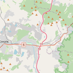
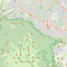


Map markers show approximate areas, not verified property addresses.
Price in context
Selected same-use offers in the same city. Asking prices, not completed transactions.
| Property | Advertised area | Plot | Price per m²* | Asking total |
|---|---|---|---|---|
| This propertyKostinbrod · Perena | 2,099 m² | 2,099 m² | €6 | €13,440 |
There are not enough sufficiently comparable current offers in our local selection. No broader market-value conclusion is drawn.
*Total asking, including stated mandatory extras, divided by advertised area. Net area, common parts, basement, land rights, condition and micro-location may differ. This is a comparison starting point, not a valuation.
What to check before deciding
Does the current cadastral sketch confirm identifier 38978.261.4 and 2,099 m²?
What registered road or easement gives lawful access to the field?
Are there leases, crop rights, subsidies or use agreements affecting possession?
What land-use, environmental or utility easement restrictions apply?
Can an independent surveyor mark the boundaries and verify the access track on site?
Is €13,440 the current agreed asking price, and what VAT and commission apply?
What the analysis is based on
- Source review
- 2026-11-02
- Gallery
- 7 images available
- Visual sample reviewed
- 3 · № 1, 4, 7
- Documents / inspection
- Not reviewed / not carried out
The specific offer remains presented for sale on the public advertiser page. This is a public listing signal, not seller confirmation of availability.
BULGARIAN PROPERTIES · Sfa 91469
Original listing and advertiser contactThe selection, in summary
Five criteria, with their evidence in view. An unassessed criterion stays unscored; missing information is not zero.
Rating not calculated. The available evidence is not yet sufficient for a defensible overall result.
No example or average pointsWhat the property information tells us
VAT treatment needs confirmation. Confirm commission and any additional mandatory charges with the advertiser. No market-price score has been calculated for this property. It requires suitable, independently checked comparisons with consistent area, tax and rights definitions.
Open price contextWhat the property information tells us
Kostinbrod · Perena Check the cadastral position, lawful road access, easements and actual utility connections. A map pin does not prove access rights.
Inspect the locationWhat the property information tells us
Land area: 2,099 m², per source. Current use: Agricultural; arable field; category IV. Confirm usable areas and rights against approved documents. More advertised square metres do not automatically earn more points.
Review the property factsWhat the property information tells us
A coloured map shows numbered strips and a highlighted narrow parcel. Check title, land classification, planning rules, utilities and restrictions independently.
What the property information tells us
No confirmed building rights or change-of-use permission are presented. Annotated gallery boundaries and visible tracks are not legal boundary or access evidence. These are matters to investigate, not proof of extra building rights, rental yield or future profit.
Review the checks before decidingWhy selected: Category IV arable designation is explicitly stated, useful for a buyer comparing agricultural parcels.
Proposed scoring method
The weights describe the proposed structure, not points awarded to this property. Once the method is calibrated, confirmed levels from 0 to 5 would convert to points as weight × level / 5.
A numerical rating requires a consistent method for the property type, suitable independent market comparisons, and an editorial review of the evidence for each criterion. Listing claims, photo observations and unresolved questions must remain distinguishable.
An overall result remains unpublished when the evidence is insufficient. Missing information is not zero; example or average points do not replace it. The current card presents the available evidence without assigning points.
Our selection principlesLooking for a similar property?
Save your criteria and revisit the source-backed collection.